Satellite SAR Interferometry and integration with Urban Cadastre Layers
Period
2015–2022
Client
Confidential
industry
Cultural Heritage
Issue
Public buildings requiring modernization under the Building Bonus are located in an area where historical deformation trends need to be evaluated. To support engineers in their decision-making process, an assessment of historical deformation trends was conducted using Sentinel-1 data, integrated with 3D cadastre layers.
Solution
A-DInSAR (Advanced Satellite SAR Interferometry) analyses were conducted using images acquired in recent years from the Sentinel-1 constellation, available in the European Space Agency (ESA) archive. This technique enabled the estimation of ground and structural displacement rates and historical trends within the area of interest. Two different satellite image datasets (with varying orbital geometries) were analyzed to investigate different types of displacements, both vertical and horizontal.
Results
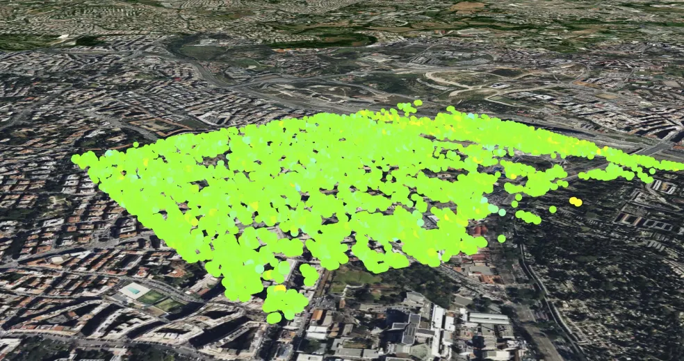
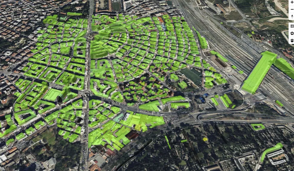
Figures 1 and 2 present the data obtained from the processing. No significant displacements were detected across the entire study area. The results, combined with field investigations conducted by the competent engineering firm, allowed for the definition of the area’s risk conditions, which were instrumental in confirming preliminary design solutions.
Figure 1: InSAR Data on the Area of Interest (AOI) – Piazza Bologna
Figure 2: Integration with Cadastre Data
Benefits
The results, combined with field investigations conducted by the commissioning engineering firm, enabled the definition of the area’s risk conditions. These insights were crucial in confirming preliminary design solutions, resulting in significant time and cost savings in the collection of historical data and trends.